- ГЛАВНАЯ
- О ЯХТЕ
- О НАС
- ХОТИТЕ С НАМИ?
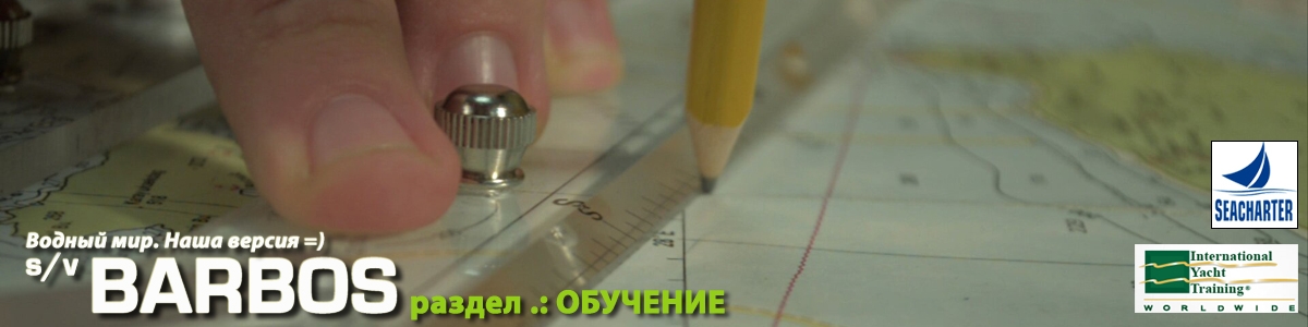
- ОБУЧЕНИЕ
- СУДОВОЙ ЖУРНАЛ
- КАЛЕНДАРЬ ПОХОДОВ
- ФОТО
- ПОЛЕЗНОЕ
- SITEMAP
- ENGLISH


NAVIGATION SYSTEMS
Immediately say, that navigation is based on laptop and not on the Chartplotter only because the latter has yet (I ordered Raymarine E90W, but at that point he had not yet arrived). When we arrived chartplotter we installed it, it is described here.
So:
Two laptops: Sony Vaio FW44MR (bought because of the size of the matrix 16.9 ") and ASUS EEEPC901 (bought was a long time ago and it was convenient for its tiny dimensions)
on both laptops has an identical set (for redundancy in case of failure of the main laptop).
Stand the following programs:
1. Franson GPSGate - performs three tasks. Takes from the GPS (in my case it's bluetooth GPS GlobalSat BT-388) and distributed on two or three virtual COM-port so that you can use several programs simultaneously navigation. The second task GPSGate - it's sending every 15 seconds (for example), our coordinates on the Internet to the server (your own or GPSGate). This is useful, for example on our website is a page current position, which reflects our current position with a delay of several seconds. True, this only works when there is a connection to the Internet =) If there is no connection, the program throws the data into the buffer until the connection. The third task - the folding data from the GPS log file on disk for later analysis and so on =)
2. Main navigation software - MaxSea v.10.3.5 card CM93ed2 May 2009 (covering the whole Earth or so). I take a working version of MaxSea module Perfomance - I liked the routing, taking into account the polar diagram of the boat and the weather forecast in a format GRIB-file. Polar diagram lying of course, but on the whole strip can roughly understand the way ahead in terms of sailing pull =)
3. Program OpenCPN - use it to display data from AIS. Unfortunately, I have on the laptop is Vista and Win7, and in both OSes OpenCPN is unstable - on a regular basis (every 15-25min), it dies. But I continue to use it because of the brevity and image quality.
4. To get weather forecasts using two programs UGrib and zyGrib. They have different display data and if the first is more convenient to me to watch common processes, the second is convenient to put a few points and see the weather forecast is in these places. In addition, the data are used here this page (for the Aegean Sea) -http://www.poseidon.hcmr.gr/sailing_foreca...hp?area_id=saeg and synoptic maps with a number of other sites.
These were the programs that are now a bit about hardware:
1. Laptop Sony VAIO VGN-FW44MR - big ... er, "laptop", although for me, so the laptop can be called laptops with a screen no more than 12 "=) my" monster "- 16,9" But I bought it deliberately because of the big screen - for easier navigation and a movie on it to watch at night =). Meal comes with an adapter 12V-> 19V. Supply current 1.5-2A.
2. "Emergency" notebook ASUS eeePC 901 - this kid (before it was 701) I was marching laptop, including car navigation and off-road and on the job (during rescue job). Small, no moving parts (I have a version with SSD rather than a hard drive), and last but not least - pretty cheap. In addition, in certain settings "lives" on the battery up to 8h.
3. AIS - I think it is very important device for safety navigation. We should transceiver. Model AIT250 AIS TRANSPONDER SYS (CLASS B ). In view of even our small and weak VHF antenna, I accept the data on commercial vessels at ranges of up to 40 miles, on the head on any radar (especially when the ship goes beyond the island). Also, I think that it is much better than any corner reflector - my data (coordinates, speed and course) are transmitted every few seconds, and all the "big" court "see" me from afar. Yes, and small vessels that are equipped with AIS-only receiver I have seen.
4. The notebook data from AIS plant through COM-> USB adapter. Please note that AIS uses the speed of 38,400 rather than the standard for NMEA 4800!
5. Data from the sonar, anemorumbometra and lag plant with a SeaTalk bus interface Raymarine - Raymarine PC-SeaTalk-NMEA Interface Box. This box allows you to transfer data in a standard format SeaTalk NMEA. In general, the network, there are examples and diagrams, how to build an analog itself. Incidentally, the bus SeaTalk HS (High Speed) - is essentially ethernet. with all the consequences (for example, there is no need to buy doroguschy cable from Raymarine, when you can take a simple ethernet-cable into the nearest computer store. The difference is only in the cap on the plug =)
6. Radar. Radar I order along with Chartplotter, but the plotters have not yet come, and the radar has not yet had time to put (or rather, now that's just a set) I bought too Radar Raymarine 18 "2kW Digital (connecting bus SeaTalk HS)
7. Chartplotter - Raymarine E90W. Just ordered this one because this is the first (from the time when they went to the Navionics) plotter understands both formats stake - and Navionics And Cmap ... But here until bummer - plotter I paid back in October, and sent it to me with reymarina only a week ago ... with a set of Navionics. CMap promise in the middle of the year, along with the patch firmware. To be honest - ugly. Of course how to get and try to - tell you about it in detail.
8. Another thing that stands with me, although it is not part of the navigation system - Raymarine LifeTag. The trick is simple and convenient - two key fob (like hours) and a block. Starts a heart-rending scream and put a flag on the MOU reymarinovskom Chartplotter. Consider it convenient.
Links to software from known reasons not spread, if anyone want to ask - write me e-mail or ask Google =)
Рекомендуем к прочтению:
ТОП-10 комментируемых новостей

Наша погода
Trieste

- Нет данных
- Температура: 26 °C
- Ветер: Переменный, 3 узлов
- Давление: 1009 гПа
- Отн. Влажность: 61 %
- Восход: 05:36 +0200
- Закат: 20:47 +0200
Вс, 21/07/2024 - 23:55
